REVIEW · SEDONA
Mogollon Rim (80+ Mile) – Sedona Helicopter Tour
Book on Viator →Operated by Apex Air Tours · Bookable on Viator
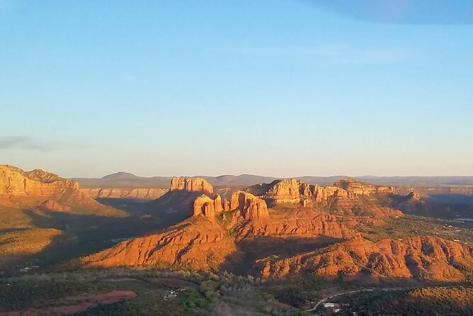
Rim views from above are hard to beat. This Mogollon Rim helicopter ride turns Sedona into a map you can fly, with aerial views over Cathedral Rock, Bell Rock, and the cliff-dwelling country around Honanki and Boynton Canyon. I also love how the route strings together big-name formations with smaller, weirder rock shapes, so every few minutes you’re pointing at something new.
My second favorite part is the setup: all forward-facing seats and noise-reduction headsets with microphones, which makes it easier to hear your pilot and keep your eyes on the scenery. The tour is built for groups too, with up to 5 in total, so it feels social without getting chaotic. A possible drawback: it’s weather-dependent, and since this is a helicopter tour, a cloudy day can mean schedule changes.
If you want a high-impact Sedona experience in under an hour, this one fits. It’s also priced like a premium activity, so you’ll want to be sure you’re ready to spend for the helicopter viewpoint.
In This Review
- Key highlights to look forward to
- The point of this Mogollon Rim helicopter tour
- Price and what you’re really paying for
- Where you meet and how the ride is set up
- The flight route: from airport overlooks to the Mogollon Rim icons
- Canyons, bridges, and big panoramas
- Ancient ruins and canyon walls: Honanki, Boynton, Long
- Sycamore Canyon stop and what “admission free” means
- Cottonwood Airport timing and the Tuzigoot National Monument view
- Comfort, group size, and who this is best for
- Weather and flight conditions you should plan around
- Flying safety basics and who should reconsider
- Tips to get great photos without losing the moment
- Should you book the Mogollon Rim helicopter tour?
- FAQ
- How long is the Mogollon Rim helicopter tour?
- Where does the tour start and end?
- How big are the groups?
- What languages are offered?
- Do all passengers sit facing forward?
- Is there a weight limit?
- What happens if the weather is poor?
Key highlights to look forward to
- Up to 5 people total for a more personal flight experience
- All forward-facing seats so you’re not stuck watching around neighbors
- Noise-reduction headsets with microphones for clearer pilot commentary
- A huge sweep of rock icons like Cathedral Rock, Bell Rock, and Devil’s Bridge
- Ancient ruins viewpoints around Honanki, Boynton Canyon, and Long Canyon areas
- One quick walk/stop at Sycamore Canyon with admission ticket free
The point of this Mogollon Rim helicopter tour
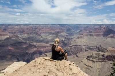
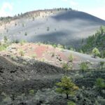
A helicopter tour in Sedona isn’t just about seeing pretty rocks. It’s about compressing distance. From the air, you can track the Mojave/Sonoran desert geology across canyons and ridges in a way you can’t match from the ground in the same time.
This flight also leans hard into variety. You get the famous Red Rock shapes, plus the “wait, what is that?” formations like the cow pies, the eagle, and the tea kettle. Then it keeps going toward ruins country, where you’ll see canyon walls and archaeological sites from above.
At 50 to 52 minutes, you’re getting a full visual hit without committing a whole day. That’s the practical win. The trade-off is that you’re in the air the whole time, so it’s not a slow, wandering experience.
You can also read our reviews of more tours and experiences in Sedona

Price and what you’re really paying for
At $712.93 per person, this is not a budget tour. You’re paying for helicopter time, a small group, and a flight path that strings together a lot of high-interest sites quickly.
Here’s how I’d judge value: the route hits many widely spaced viewpoints (Cathedral Rock, Bell Rock, Devil’s Bridge area, Honanki ruins area, Boynton Canyon, Long Canyon, and more) within about an hour. On the ground, seeing this many areas would take longer drives, more stops, and more chances to miss something due to lighting or timing.
Also, the included gear matters more than it sounds. Forward-facing seats plus headsets with microphones can make the difference between “I’m just looking out the window” and “I can actually follow what’s happening up there.”
If you’re trying to do Sedona on a tight schedule or you’re visiting once and want the aerial version, the price starts to make sense. If you’re the type who loves long hikes and slow stops, you may find this feels short.
Where you meet and how the ride is set up
You’ll meet at 1225 Airport Rd, Sedona, AZ 86336, and the tour ends back at the same meeting point.
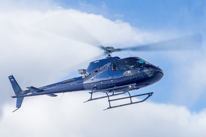
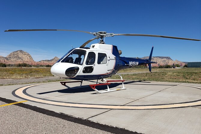
You’ll travel in an air-conditioned vehicle, and you’ll ride in a helicopter with all forward-facing seats. That might sound like a small detail, but it’s huge for comfort and viewing. You’re not turning your head around to see the best angles, and everyone gets the same “this is the view” perspective.
You’ll also use noise-reduction headsets with microphones. In a helicopter, sound is often the first thing that gets chaotic. Here, it’s set up to keep your pilot’s guidance and storytelling understandable.
The flight route: from airport overlooks to the Mogollon Rim icons
The tour starts with a fly-by over the Sedona Airport overlook. It’s a quick warm-up: you get your bearings fast and can see how the town sits in the red rock basin before the canyons and ridges widen out.
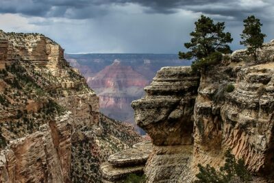
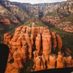
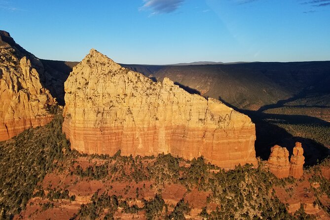
Then you head into the big Red Rock headliners. You’ll fly past Cathedral Rock and Bell Rock, with aerial views that make their shapes look almost architectural. From above, you can see how those formations relate to the surrounding canyon walls, not just how they look in a photo from one angle.
After that, the flight shifts into a more playful zone of recognizable rock characters: Submarine Rock, Snoopy Rock, Chicken Point, and the Praying Hands. From the ground, those names can feel like a gimmick. From the air, they become way clearer because you see the formations in relation to ridge lines and drainage channels.
You’ll also get views of rock formations described as the cow pies, the eagle, and the tea kettle. These are the kinds of points where you might think, okay, I’ve heard the name, but you’ll want your camera ready because the aerial perspective turns them into obvious silhouettes.
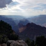
Canyons, bridges, and big panoramas
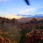
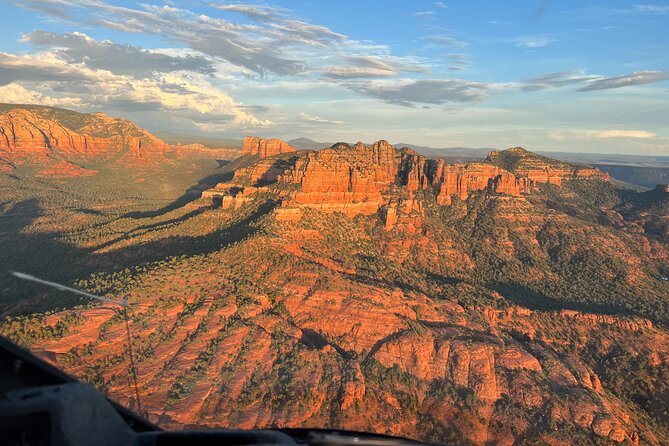
Next comes more canyon geometry. You’ll see Oak Creek Canyon and Midgley bridge from above as you fly through that stretch of terrain. Bridges in canyon country tend to look like tiny lines from the ground, but from the air they show you the “problem solving” of where crossing points land.
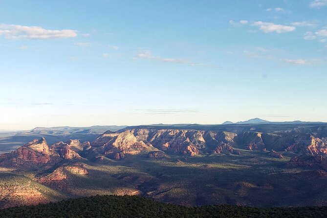
Then you’ll fly over Brins Mesa for panoramic views. Mesa country is where you really understand spacing in Sedona: how ridges stack, how the land falls away, and why the Mogollon Rim draws attention in the first place.
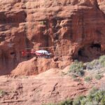
A standout aerial moment is Devil’s bridge, which you’ll view as you fly past. From above, it’s easier to appreciate the scale and how the rock form sits in the broader canyon context.
If you’re the person who always wonders what a viewpoint is actually facing, this portion helps answer that. You’re not guessing anymore. You’re seeing the whole layout.


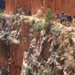
Ancient ruins and canyon walls: Honanki, Boynton, Long
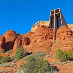
This is where the tour feels more than scenic sightseeing. You’ll get views of the Honanki ruins as you fly by.
From there, the flight continues through areas with more ancient-canyon presence: you’ll see ancient ruins as you fly through Boynton Canyon and then again as you fly through Long Canyon.
Even if you don’t know the details of each site, aerial views do something useful. They show the terrain that archaeologists had to deal with—where people could settle, where walls provided shelter, and how canyon breaks shape movement. That’s the kind of context that’s hard to fully grasp from a single trailhead photo.
The reviews emphasize that the pilot shares history and context, and that you feel comfortable and safe throughout. Practically speaking, that means you’ll likely get more than just site names. You’ll get the “why here” behind what you’re seeing.
Sycamore Canyon stop and what “admission free” means
One section includes a Sycamore Canyon stop with 10 minutes and admission ticket free.
This is your brief chance to reset your eyes from the helicopter windows and take in the area more directly. Ten minutes is short, but it can be enough to orient yourself—especially after you’ve been looking at ridges and formations from above.
Since the time is limited, keep expectations realistic. This isn’t a long hike or a full museum-style stop. Think of it as a quick scenery break and a moment to capture photos that aren’t filtered through airplane glass.
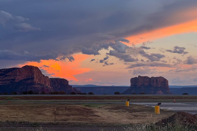
Cottonwood Airport timing and the Tuzigoot National Monument view
The tour also notes views of Tuzigoot National Monument as you depart and arrive from the Cottonwood Airport.
That matters because it shows the route isn’t just orbiting Sedona. You’re getting a broader regional sweep, which helps explain why the tour can cover so much in a short time.
You’ll also see Jerome as you fly toward Sycamore Canyon, along with Mingus Mountain and the Woodchute wilderness area as you pass from Sycamore Canyon to Jerome. Plus, you’ll get views of the Verde River as you soar above.
So even if you’re mainly interested in the Red Rock icons, you’ll still get a “bigger picture” view of the surrounding geography.
Comfort, group size, and who this is best for
This activity lists a maximum of 6 travelers, and it’s described as going with up to 5 in total in your group. Either way, it’s a small-group experience.
That size is a big deal. Helicopter tours can feel crowded fast, especially when everyone wants the best camera angles. With a tighter group, you’re more likely to enjoy the flight rather than negotiate space.
It’s also a good pick for first-time Sedona visitors who want a signature activity. You’ll hit famous formations, plus ruins areas, without building a day of car logistics.
It may be less ideal if you hate short stops and want slow time. This tour is fast, aerial, and focused. You’re paying for altitude and coverage, not leisurely wandering.
Weather and flight conditions you should plan around
This tour requires good weather. If conditions are poor, the tour may be canceled, and you’ll be offered a different date or a full refund.
That’s not a small point with helicopters. If skies are messy, flights can’t safely happen.
My advice: if you can, keep your Sedona schedule flexible. If your trip is locked to one day only, confirm what options you have if weather disrupts plans.
Flying safety basics and who should reconsider
There are a few clear safety rules. The tour notes that you’re prohibited to fly if you’re sick. It also says you can fly if pregnant.
There’s a weight limit too: total weight per passenger is 269 lbs. If you’re near that number, it’s smart to double-check before booking so there are no surprises.
Also, you’ll be in a helicopter, so keep in mind typical motion sensitivity. The tour does include headsets and a vehicle transfer, but it can’t remove the basic experience of rotor craft movement.
Tips to get great photos without losing the moment
You’ll want your camera ready, and the route gives you lots of photo opportunities: rock formations, canyon stretches, and ruins viewpoints.
Still, don’t treat this like a photo shoot where you forget to enjoy it. Some of the best aerial moments are the “shape reveals”—when you see how a formation sits in a canyon system. Glance quickly, then watch the view unfold.
Dress in layers. You’re flying, so temperatures can feel different than they do on the ground. And if you wear glasses, make sure they’re secure so you’re not adjusting while you’re trying to see.
Finally, listen when your pilot describes what you’re passing. With headsets and microphones, you can catch more context than you’d expect. That turns your photos into something you can actually understand.
Should you book the Mogollon Rim helicopter tour?
I’d book this if you want a high-coverage Sedona experience in under an hour, and if you care about seeing both famous formations and ancient ruins from above. The forward-facing seats, noise-reduction headsets, and the pilot’s history-and-safety approach (as emphasized in feedback about comfort and professionalism) make it feel like a guided experience, not just a thrill ride.
I’d hesitate if weather risk is a problem for your schedule, or if you’d rather spend your time hiking and exploring slowly on the ground. At $712.93 per person, you’re paying for speed and aerial access, so it’s best for travelers who really want the helicopter viewpoint.
If you’re planning one standout Sedona activity, this is a strong candidate—especially because it covers a lot of the region’s most named rocks and canyon-country landmarks in one go.
FAQ
How long is the Mogollon Rim helicopter tour?
It runs about 50 to 52 minutes.
Where does the tour start and end?
You’ll meet at 1225 Airport Rd, Sedona, AZ 86336, and the tour ends back at the same meeting point.
How big are the groups?
The tour lists a maximum of 6 travelers, with up to 5 in your group.
What languages are offered?
The tour is offered in English.
Do all passengers sit facing forward?
Yes. The tour includes all forward-facing seats.
Is there a weight limit?
Yes. Total weight per passenger is listed as 269 lbs.
What happens if the weather is poor?
This experience requires good weather. If it’s canceled due to poor weather, you’ll be offered a different date or a full refund. You can cancel up to 24 hours in advance for a full refund.